
 Here’s undoubtedly THE biggest news since Superstorm Sandy hit on October 29, 2012:
The first new FEMA flood maps in 25 years were issued yesterday. For a summary on the new maps and stunning photos, check out the Jan. 28, 2013 New York Daily News:
The story contains a link to the website of Region 2 FEMA, where you can input your home address and view the map. Residents interviewed for this story and other news stories of the past several months, comment on the unknown future risk of storm damage as a salient concern. Those of us living on the peninsula since the storm know that many conversations with neighbors come around to this point, as well. Was Superstorm Sandy just the “100 year storm” we can now put behind us and move on with our lives? Do we need that fun game in a box, the Ouija board, to figure out the future risk?
For those seeking answers more reliable than what you’d get from a fortune-telling toy, it is interesting to view a February 2006 interview with Professor Nicholas Coch of Queens College, from the CBS News website. Professor Coch speaks about the monumental 1893 hurricane that made a direct hit on New York City, shutting down the New York Stock Exchange and washing away the entire outer beach off of Far Rockaway. He says the full six columns of the following day’s front page of the New York Times were devoted to the storm. Here is the link to the interview:
http://www.cbsnews.com/video/watch/?id=1847560n
It would also be educational to review the following summary of important storms of the past 100 years, which I have culled from records of the U.S. Army Corps of Engineers (USACOE), the 110th Anniversary edition of The Wave, and other historical sources. It shows large gaps of time between some of these events. Congratulations are in order, as we have just lived through the largest of these gaps, which was 19 years with no important storms of note, between the 1992 Nor’easter and Hurricane Irene in 2011. Unfortunately, it also shows disturbing cycles of multiple storms in quick succession, including two years, 1954 and 1960, when there were two severe storms in one season.
Major Storms of the Past Century to Hit the Rockaways
Jan. 5, 1914–Bellot’s History of the Rockaways: Severe storm and fire tore up, burned and washed away the boardwalk built by private hoteliers in Arverne, prompting calls for a new boardwalk from Far Rockaway to Neponsit.
1920—Wave: storm damaged beaches, which were strewn with clams!
1936—Wave: no-name hurricane damaged beaches
1938—Wave: Long Island Express hurricane damage
1944—Wave: no-name hurricane damaged beaches
Nov. 1950—USACOE: Storm damaged Holland boardwalk and Broad Channel extensively
Nov. 1953—USACOE: Rockaway Pt. damaged heavily after storm
Aug. 31, 1954—USACOE: Two named storms, hurricanes Carol and Edna, damaged Rockaway.
July 30, 1960—USACOE: Storm caused flooding (particularly in Far Rockaway)
Sept. 1960—USACOE: Hurricane Donna flooded the peninsula again.
March 8, 1962—USACOE: Bad storm damage throughout peninsula
Dec.-Jan. 1963—Wave: 3-day storm caused much damage
Winter 1970-71—Author Lawrence Kaplan: Bad storms led to severe beach erosion. At least 14 blocks of the beach had completely disappeared by 1973.
Feb. 1972—Wave: heavy erosion and damage from storm.
April-May 1973—Wave: Rockaway’s beaches damaged severely from East to West. Heavy erosion and washouts all over during this period of time.
June 1973—NYC Parks photo archive: Mayor Lindsay inspected beaches with USACOE.
July 14, 1975—Long Island Press: Beaches filled in completely by USACOE
Sept. 1985—Wave: Hurricane Gloria strikes NYC and Long Island.
Dec. 11, 1992—Wave: Nor’easter causes major flooding on peninsula.
August 2011—Hurricane Irene causes major flooding on peninsula.
October 29, 2012—Superstorm Sandy causes massive destruction on peninsula.
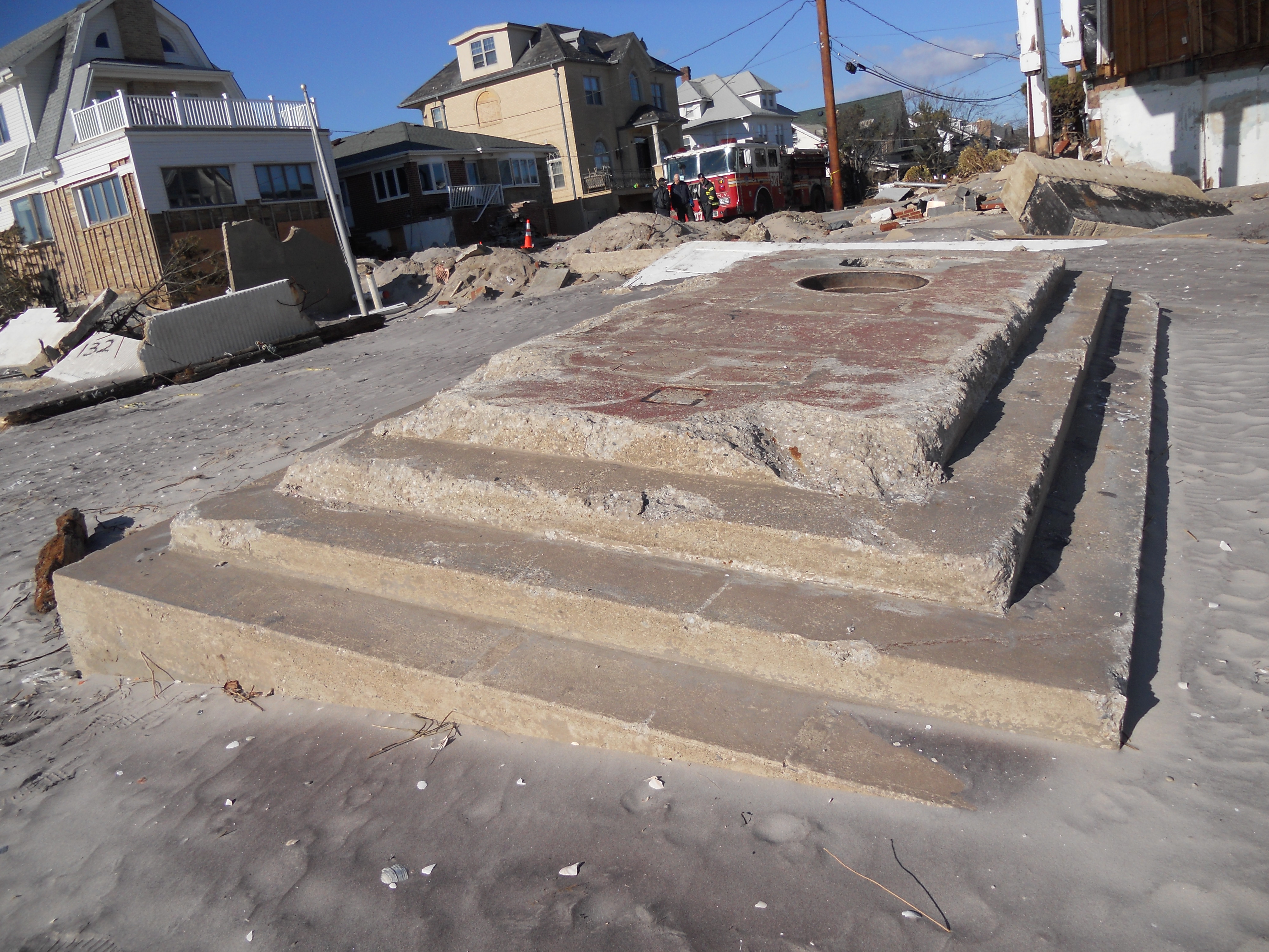
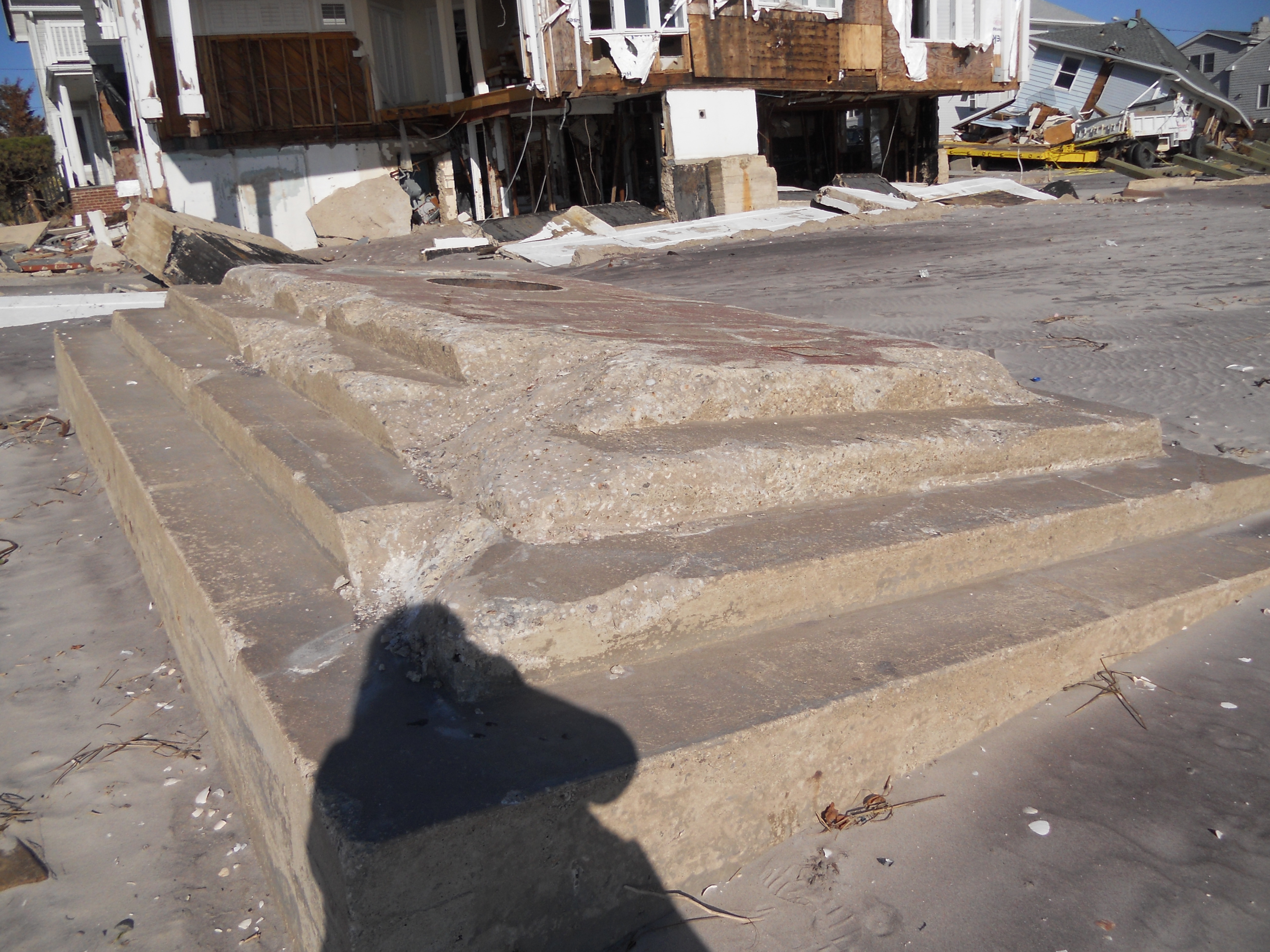
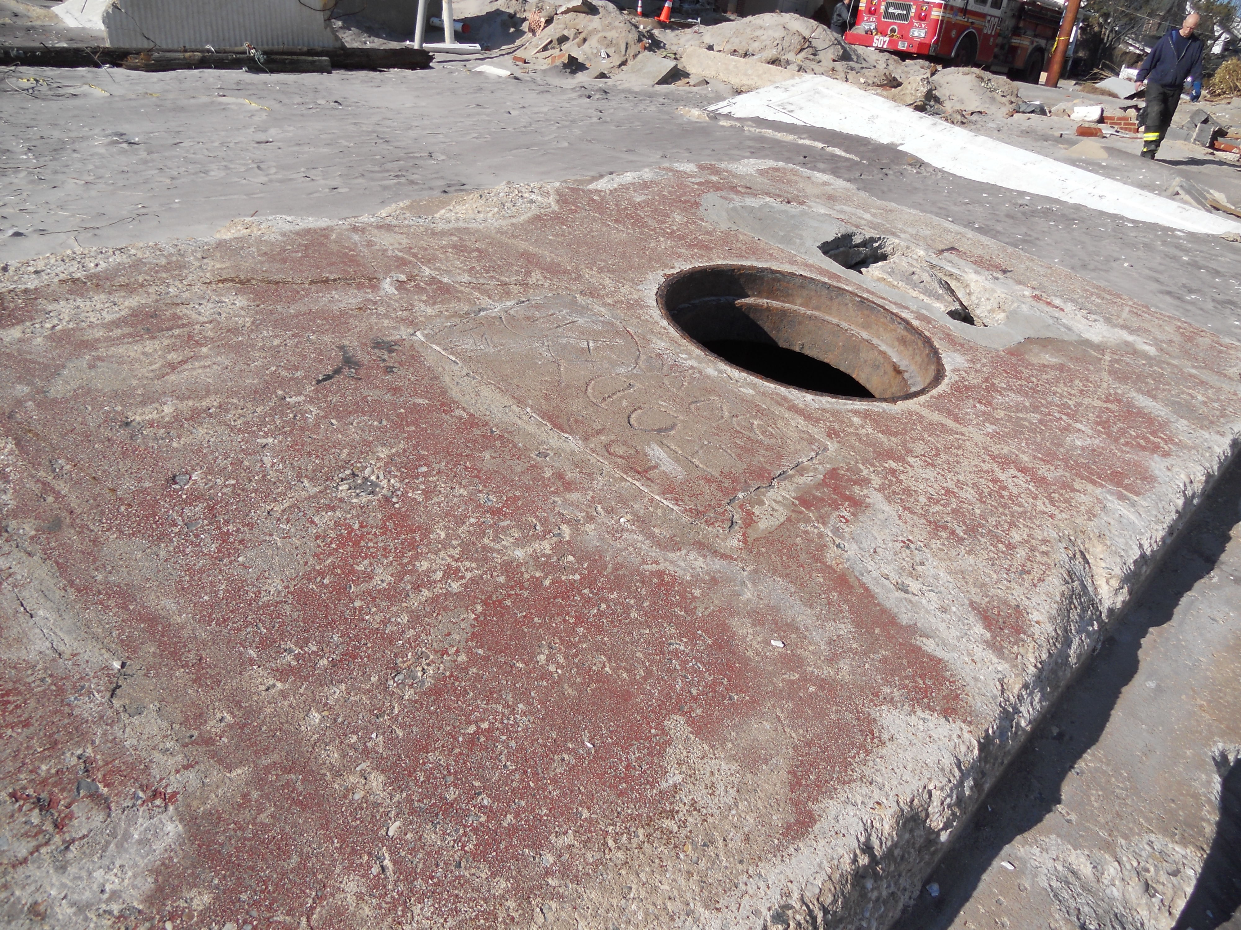
I have only provided some important clues through this summary; I leave it to responsible officials of the city, state and federal government to fill in the historical details on the measured extent of damage from each of these storms of the past century, so we can make responsible decisions as homeowners on how to proceed. I was told that two concrete structures (one of which is shown in the header photo), now visible on the sand in the Beach 130’s, had been submerged since at least the 1950’s. That might provide another tantalizing clue.
Text and photos copyright Vivian R. Carter 2013.
